On the ground
Indonesia's Fire Season Is Already Breaking Records — and El Niño Hasn't Peaked Yet
Hotspot counts are higher than at any point on record, peatland fires have surged more than forty-fold in some regions, and forecasters warn the strongest El Niño in 150 years is still building.
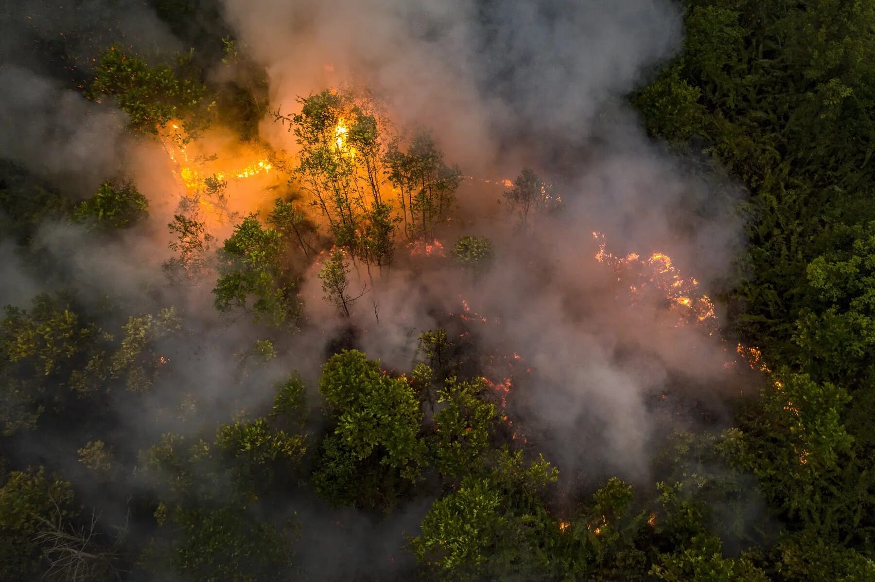
By the last week of July 2026, Indonesia's satellites had logged more than 96,000 fire hotspots since the start of the year - the highest tally on record for that point in the calendar, ahead of the 88,000 counted by the same date in 2019 and the 58,000 seen in 2023, both previously ranked among the country's worst haze years. More than 100,000 hectares had already burned in the first half of the year alone, roughly double the full-year total for 2023.[1,2]
A dry season arriving early and hitting harder
Indonesia's Meteorology, Climatology and Geophysics Agency (BMKG) has been blunt about what is driving the numbers: a strengthening El Niño is pushing the 2026 dry season to be "more intense and prolonged than usual," elevating both drought and wildfire risk across Sumatra, Kalimantan, and beyond.[2] Independent climate scientists have gone further. An analysis cited by Eco-Business put the odds at 90 percent that the El Niño now developing in the tropical Pacific will become the strongest in roughly 150 years of observations - surpassing the record-breaking event of 2015–16, which itself produced some of the worst transboundary haze Southeast Asia has ever experienced.[1]
The geography of this year's fires tracks closely with Indonesia's carbon-richest landscapes. Peatland fires alone have burned an estimated 48,890 hectares across Riau, Jambi, South Sumatra, Central Kalimantan and South Kalimantan.[2] In the Tripa peat swamp of Aceh - one of the last remaining lowland peat forests on Sumatra's west coast and habitat for critically endangered Sumatran orangutans - hotspot counts rose more than forty-threefold, from just 12 between January and May 2025 to 528 over the same months this year.[1] South Papua recorded 1,310 hotspots in peat areas and 399 within National Strategic Project zones in the first nine days of July alone.[1]
"Deep peat soil, limited water supplies, difficult access and strong winds have complicated efforts" to contain the blazes, officials told reporters - and cloud-seeding, often deployed to induce rain over fire zones, was ruled out this year after monitoring found no rain-bearing clouds suitable for weather modification.[2]
The response on the ground
Indonesia has mobilised close to 50,000 firefighters and disaster-response personnel, backed by dozens of helicopters conducting water bombing runs.[2] Jambi province alone has deployed roughly 6,000 firefighters. The largest single blaze recorded this season burned 743 hectares inside Bromo Tengger Semeru National Park in East Java.[2] The Ministry of Environment has ordered concession holders to strengthen prevention measures; roughly 4.15 million hectares of company-managed land are already equipped with some 35,000 canal blocks designed to keep peat saturated and less flammable, though officials estimate more than 17,000 additional blocks are still needed nationwide.[1] Companies found responsible for fires on their concessions face administrative, civil or criminal sanctions.[1]
Why peat fires matter more than the hectare count suggests
Not all fires are equal. When a peat swamp forest is drained for agriculture and then ignites, it does not simply burn the vegetation on top - it burns the soil itself, releasing carbon that has been locked away for thousands of years and is difficult, sometimes impossible, to replace on any human timescale. That is one reason peatland fires draw outsized concern relative to their footprint, and why Indonesia's 2026 season, concentrated so heavily in peat-rich Sumatra, Kalimantan and Papua, carries climate consequences well beyond its immediate haze and health impacts.
The pattern also fits a troubling global signal. The 2025 Global Carbon Budget found that the world's combined land and ocean carbon sinks are weakening under climate change, with tropical forests in Southeast Asia and South America identified among the regions at risk of flipping from net absorbers of carbon to net sources.[3] A severe El Niño fire season across Indonesia's peatlands is precisely the kind of event that can tip that balance in a single year.
What comes next
Indonesian officials have flagged August and September as the most critical months of the current dry season, meaning the final tally for 2026 is likely to climb well past the figures already on record.[2] The season is a stark reminder that protecting standing peat and forest carbon is not a one-time transaction - it requires sustained fire prevention infrastructure, community-based early warning, and monitoring that holds through the driest, highest-risk years, not just the easy ones.
Sources
1. Indonesia records surge in fire hotspots ahead of Super El Niño - Eco-Business
2. Wildfires burn across Indonesia as officials cite El Nino as a cause - Al Jazeera
3. Fossil fuel CO2 emissions hit record high in 2025 - Global Carbon Budget